
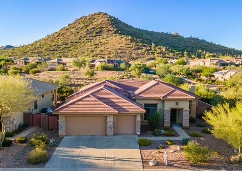
North Phoenix
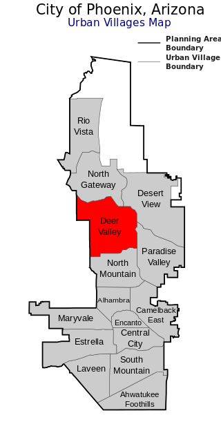
The Phoenix North Region is primarily the City of Phoenix north of Thomas Road.
The region also includes the unincorporated communities of Anthem and New River to the North.
While the area with this name has no official separate status, it usually refers to the Urban Villages of North Mountain, Deer Valley and North Gateway.
Click here to discover more about Anthem.
Anthem also has convenient shopping all in one place.
Click here to visit Outlets at Anthem.
For modern restaurants, shopping, seasonal entertainment and movies be sure to click here and visit the Shops at Noterra.
Click here to discover more about the community of New River.
History:
Mining activity took place in the small town of Union beginning in the 1880s in the area currently referred to as Deer Valley (also near the Union Hills which bear its name).
It eventually declined and left only a few ruins, making it a ghost town. The last remnants were bulldozed in the 1990s to make way for new construction.
The old state route that is now Cave Creek Road went between Phoenix and the town of Cave Creek.The small, unincorporated town of Cactus existed near what is now the intersection of Cactus Road and Cave Creek Road until the 1960s, when it was annexed by Phoenix.
Other named places nearby included Valley Heights and Montgomery. These locations are now within Phoenix’s city limits.
The US Air Force established the North Phoenix Airport as a facility for military use at sometime around 1945-48 but dismantled it after the 1960s. In 1963, North Phoenix Chamber of Commerce was established.
With the failure of agricultural development, which was concentrated mostly to the west and southeast of the Phoenix metropolitan area, North Phoenix contained only a small number of ranch homes, horse ranches, and a few small businesses for many decades. The rest of the area was open desert.
After the mid-20th century this began to change rapidly as many new suburban housing developments, shopping centers, and office buildings continue to be built.
Modern Transportation Info:
Many residents commute by automobile to work in central Phoenix or other Valley cities.
Major east-west arterial streets include Bell Road, Union Hills Drive, Greenway Road, and Thunderbird Road.
Major north-south streets that serve the area most include 7th, 19th and 35th Avenues, and 7th, 24th, and 40th Streets as well as Tatum Boulevard (essentially an arterial extension of 48th Street). Interstate 17, State Route 101 (Loop 101), and State Route 51 serve this community.
Phoenix Deer Valley Airport handles general and corporate aviation and is the busiest airport of its type in the country.
Valley Metro bus routes operate here. Several new routes have been implemented in North Phoenix because of rising demand. RAPID buses, so called due to their use of freeways to link suburbs with central Phoenix, have stops near Bell Road and I-17 and Route 51.
More transit centers are planned in the future as roads and freeways near capacity and few other options exist to accommodate transportation needs.
Valley Metro Rail, part of the Valley Metro system, is slated to be extended to North Phoenix in the very long term, although the plans have been postponed because of scarce funding and high costs.
Certainly, there will be much more to come as the City of Phoenix expands and welcomes many new families every month!
Sorry we are experiencing system issues. Please try again.